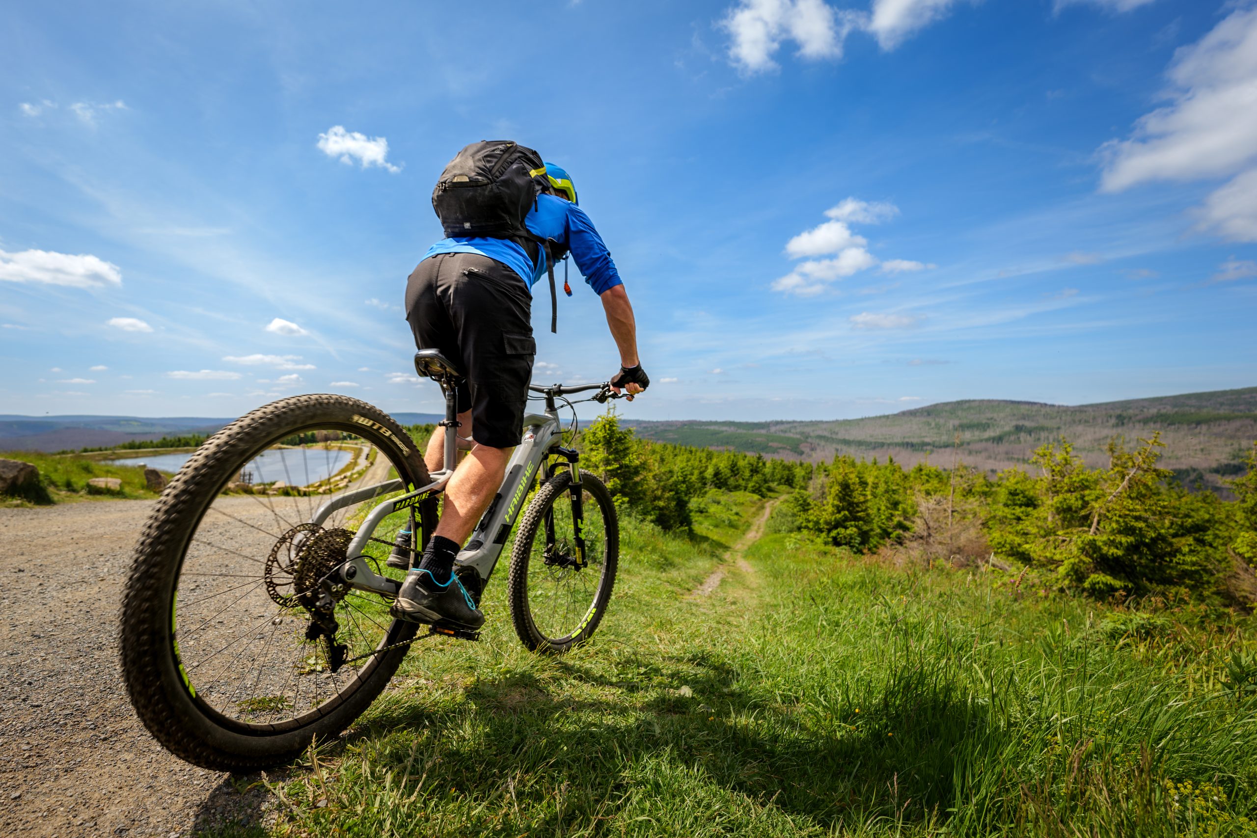

Vom Stöberhai zum Matthias-Schmidt-Berg 
20,4 km und 541 Höhenmeter erwarten dich auf diesem Abschnitt des Devils Trail.
Strecke und Landschaft
Vom Stöberhai im Südharz verläuft deine Route wieder hinauf in den Oberharz. Auf einer schnellen Schotterstrecke passierst du bergab die Odertalsperre, dann geht es auf schmaleren Wegen leicht wellig weiter, später nur noch bergan zum Matthias Schmidt Berg bei Sankt Andreasberg.
Was findest du unterwegs?
- Oberhalb von Bad Lauterberg: Südharzer Wanderparadies Odertal und Odertalsperre (Wassersport, Angeln)
- MSB X-Trail (Downhill Parcours)
Einkehrmöglichkeiten
St. Andreasberg, Matthiasbaude (Matthias-Schmidt-Berg)
Unterkunft
TIPP Mountainbike-freundlicher Gastgeber in St. Andreasberg
Pension Alfa www.hotel-pension-alfa.de
Weitere Unterkünfte in St. Andreasberg
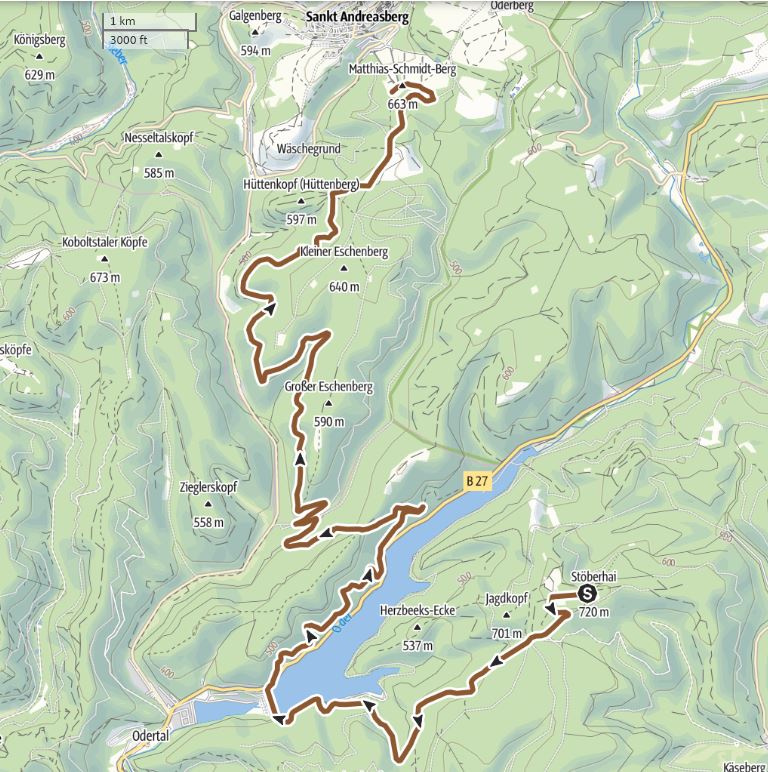
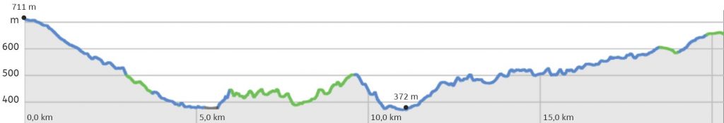
Zu Online-Karte, Höhenprofil und GPS Daten dieser Teilstrecke
To the online map, altitude profile and GPS track for this stage
Übersicht / Overview © outdooractive (Original mit Klick auf die Karte)
![]() From Stöberhai to Matthias-Schmidt-Berg
From Stöberhai to Matthias-Schmidt-Berg
20.4 km and 541 altitude metres await you on this section of the Devil’s Trail.
- Mountain meadows around Sankt Andreasberg
- Oder Valley embedded in high mountains
- "Berg-Erlebniswelt-Wurmberg" with cable car, downhill bike park and monster scooter
St. Andreasberg, Braunlage, Rinderstall, Wurmberg-Baude, Rodelhaus (side trip)
Pension Alfa www.relexa-hotel-braunlage.de
Further accommodation in Sankt Andreasberg