Überblick 
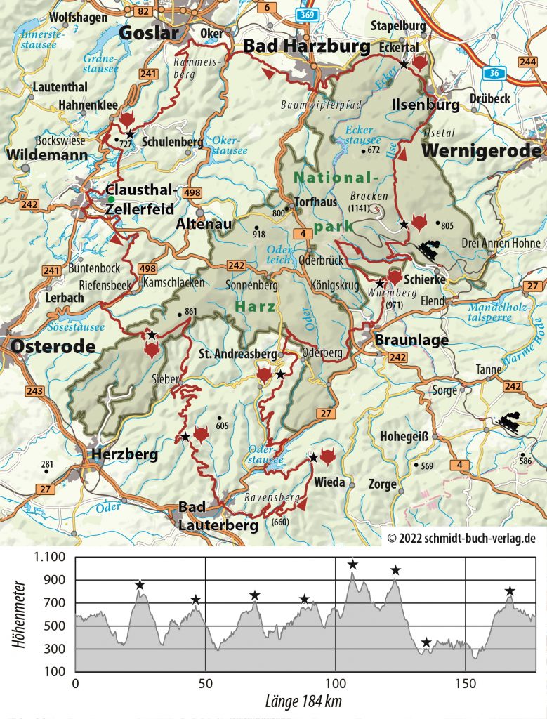
184 km und 4300 Höhenmeter erwarten dich auf dem Devils Trail. Du kannst starten, wo du möchtest, denn es ist eine Runde!
Zu Online-Karte, Höhenprofil und GPS Daten der Gesamtstrecke
Online-Infos zur Gesamtstrecke mit Links zu den Teilstrecken
Übersicht mit Höhenprofil

Kurze Beschreibung jeder Etappe von Checkpoint zu Checkpoint
Von der Schalke zur Hanskühnenburg
Von der Hanskühnenburg zum Großen Knollen
Vom Großen Knollen zum Stöberhai
Vom Stöberhai zum Matthias-Schmidt-Berg
Vom Matthias-Schmidt-Berg zum Wurmberg
Vom Wurmberg zum Gelben Brink
Vom Gelben Brink zum Jungborn
Vom Jungborn zur Schalke
![]() Overview
Overview
You can start wherever you like because it is a circular route!
Online map, altitude profile and GPS data of the whole route
Online information about the whole route with links to all stages
Online map, altitude profile and GPS data of the whole route
Online information about the whole route with links to all stages

