Auf dem Mountainbike über Stock und Stein 
Was ist der Devils-Trail?
Diese ambitionierte Mountainbike-Runde mit 4.300 Höhenmetern auf 184 Kilometern führt dich an den Nordrand und auf die Sonnenseite des Harzes und zwischendrin zweimal übers Gebirge. Der Devils Trail ist ein anstrengender Ritt durch eine faszinierende Landschaft mit duftenden Bergwiesen und Wäldern von sehr unterschiedlichem Charakter. Du erklimmst dabei acht hohe Harzgipfel.
Über welchen Untergrund geht es auf dem Devils Trail?
Der Devils Trail führt über 118 km Schotterweg, 34 km Trails (Naturweg), 23 km Asphaltstrecke und fast 9 km über Straßen.
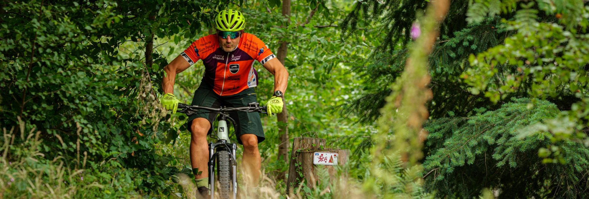
Ist der Devils Trail ausgeschildert?
Ja. Der Devils Trail ist im Gelände vollständig ausgeschildert und verläuft auf Teilstücken von (ebenfalls ausgeschilderten) Routen der Volksbank Arena Harz. Die Pfosten sind jeweils mit Schildern für den Devils Trail und für die MTB-Route der Volksbank Arena Harz markiert. Im Nationalpark Harz sind beide Markierungen an den dortigen Stil angepasst.
Was ist die Volksbank Arena Harz
Das ist ein riesiges Mountainbike-Routennetz im Harz. Es heißt so, weil die regionalen Volksbanken gemeinsam Namenssponsor sind, und es umfasst 74 ausgeschilderte Rundrouten. Alle Strecken zusammen haben eine Länge von 2.300 km mit insgesamt 50.000 Höhenmetern und 31 Startorten. Die Gesamtstrecke erschließt eine abwechslungsreiche Mittelgebirgslandschaft von ca. 60 x 40 Kilometern Fläche. Mehr Informationen über die einzelnen Routen, die Orte und die MTB-Infrastruktur sowie die GPS Daten zu allen 74 Rundrouten findest du unter www.volksbank-arena-harz.de.
Was ist ein Nationalpark?
Der Nationalpark Harz schützt nach weltweit gültigen Standards in besonderem Maße die urwüchsige Natur. Dieses ausgedehnte Harzer Schutzgebiet spielt in derselben Liga wie der Grand Canyon in den USA oder die Victoriafälle in Sambia/Simbabwe. Mehr Informationen unter www.nationalpark-harz.de.
Von weltweiter Bedeutung ist übrigens auch das UNESCO Welterbe im Harz (Rammelsberg, Altstadt Goslar und Oberharzer Wasserwirtschaft,(ein einmaliges historisches Energiesystem).
Kann ich den Devils Trail in beiden Richtungen fahren?
Nein. Der Devils Trail ist nur in einer Richtung ausgeschildert, die Fahrtrichtung ist damit vorgegeben. Mit dem Finger auf einer Landkarte fährst du die Runde auf dem Devils Trail entgegen dem Uhrzeigersinn.
Wann ist die beste Jahreszeit für den Devils Trail?
Optimal ist die Tour zwischen Anfang Mai und Ende Oktober. Vorher liegt oft noch zu viel Schnee in den Hochlagen, später gibt es in den Mittel- und Hochlagen häufig viel Nebel und Stürme.
Muss ich den Devils Trail in einem Rutsch fahren?
Nein. Nur wenn du wirklich sehr gut trainiert bist, solltest du die Runde an einem einzigen (langen) Tag fahren. Besser kannst du dir dafür einen sportlichen Wochenend- oder Kurzurlaub gönnen, oder du verteilst die Strecke auf mehrere Tagestouren in einem längeren Zeitraum – du hast freie Wahl. Wichtig ist ganz allein, die gesamte Runde zu fahren und das mit den acht Stempeln auf deinem Tourbook zu beweisen.
Sind die Teilstrecken als Tagesetappen gedacht?
Nein. Die Teilstrecken sind sehr unterschiedlich, was Kondition und Fahrtechnik angeht. Sie sind nicht als Tages-Etappen geplant, deshalb kannst du an jeder Stempelstelle selbst entscheiden, ob du noch Zeit und Kraft für die nächste Etappe hast. Die Online-Beschreibungen der Etappen findest du hier.
Was hat der Devils Trail mit der Harzer Wandernadel zu tun?
Als Nachweis, dass du den Devils Trail wirklich gefahren bist, brauchst du acht bestimmte Stempel von den insgesamt 222 Stempelstellen der Harzer Wandernadel. Sie sind vor allem unter Wandernden sehr beliebt, denn die Stempelkästen stehen an touristisch attraktiven Stellen mit viel Geschichte oder gutem Ausblick. Wer genügend Stempel in seinem individuellen Wanderpass erreicht hat, wird Wanderkaiser oder -königin, die jüngsten Wanderprinzessin oder -prinz. Mehr Informationen unter www.harzer-wandernadel.de
![]() About route and landscape
About route and landscape
By the way, the UNESCO World Heritage Site in the Harz Mountains consisting of the Historic Town Centre and the Rammelsberg Mine in Goslar as well as the Upper Harz Water Management System (a historic water power system) also is of global importance.