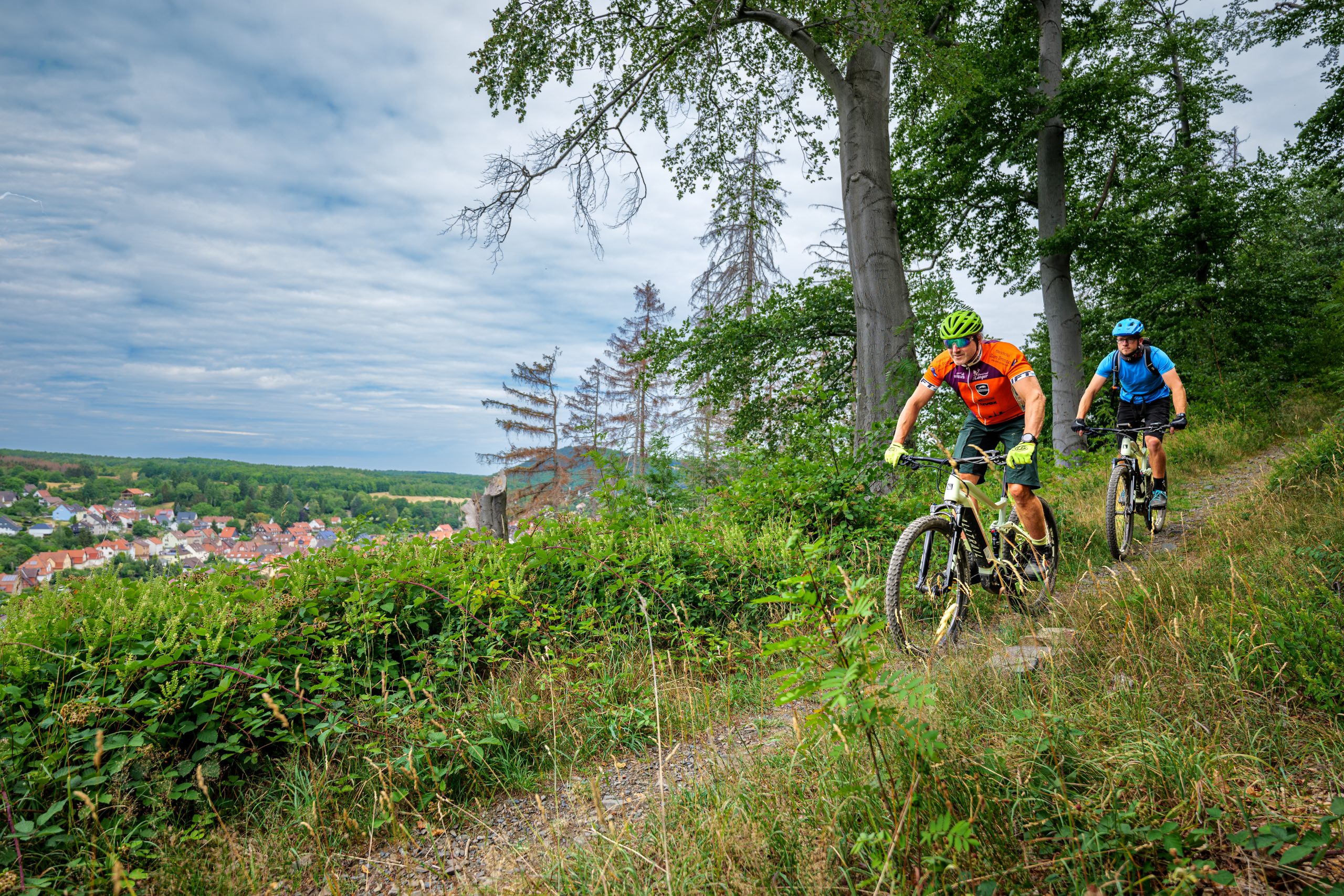
Der Devils Trail – ganz schön anstrengend 
184 km und 4300 Höhenmeter erwarten dich auf dem ausgeschilderten Devils Trail – ein ambitionierter Ritt durch Himmel und Hölle! Der Clou: du kannst starten, wo du möchtest, denn es ist eine Runde!
Zum Überblick und Höhenprofil der Gesamtstrecke
Beschreibung der Etappen von Checkpoint zu Checkpoint
Von der Schalke zur Hanskühnenburg
Von der Hanskühnenburg zum Großen Knollen
Vom Großen Knollen zum Stöberhai
Vom Stöberhai zum Matthias-Schmidt-Berg
Vom Matthias-Schmidt-Berg zum Wurmberg
Vom Wurmberg zum Gelben Brink
Vom Gelben Brink zum Jungborn
Vom Jungborn zur Schalke
Der Devils Trail führt dich durch den Harz, ein kleines Gebirge, das aus der norddeutschen Tiefebene hoch aufragt. Du fährst durch alle seine Höhenlagen und Landschaften, durch lichte Laubwälder, dunklen Nadelwald und erklimmst dabei acht hohe Harzgipfel.
Unterwegs kommst du an Talsperren vorbei, die Norddeutschland mit Trinkwasser versorgen, überquerst das Grünes Band, das den Harz und ganz Deutschland bis 1989 geteilt hat. Auf der Clausthaler Hochebene triffst du auf duftende Bergwiesen und viele steingefasste Gräben und historische Teiche, in Goslar blickst du auf 1000 Jahre bedeutende Industriegeschichte – beide stehen heute als UNESCO Welterbe unter besonderem Schutz.
Viel Spaß auf dem Devils Trail!
![]() The Devil’s Trail – seriously challenging!
The Devil’s Trail – seriously challenging!
To the overview and altitude profile of the whole route
Short description of the stages from checkpoint to checkpoint
From the Schalke to Hanskühnenburg
From Hanskühnenburg to the Große Knollen
From the Große Knollen to Stöberhai
From Stöberhai to Matthias-Schmidt-Berg
From Matthias-Schmidt-Berg to the Wurmberg
From the Wurmberg to Gelber Brink
From Gelber Brink to Jungborn
From Jungborn to the Schalke
The Devil's Trail takes you through the Harz, a small range of mountains that rises up from the north-German lowlands. You will ride through all of its highest areas and landscapes, through leafy deciduous woodlands and dark coniferous forests, and climb eight of the Harz's highest peaks.
On the way you will pass reservoirs that supply northern Germany with drinking water and cross the "Green Ribbon" of the former Iron Curtain, where the Harz and the whole of Germany were divided until 1989. On the Clausthal Plateau you will discover flowering mountain meadows and the many stone-walled ditches and historic ponds; in Goslar you will encounter 1000 years of fascinating industrial history. Both are specially protected today as UNESCO World Heritage.
Have fun on the Devil's Trail!